


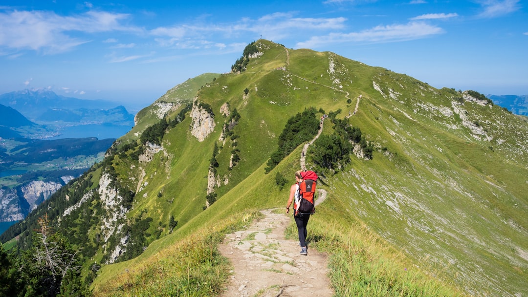
I woke up with the taste of limestone dust in my mouth and the sound of a shepherd's dog barking three kilometers away. I was sitting on a rock in Montenegro, watching a hawk circle a ridge that looked sharp enough to cut glass. This isn't a manicured park path where you can buy a smoothie every five hundred meters. This is the Via Dinarica, a raw, rugged spine running over 1,200 kilometers from the Adriatic coast up to the Austrian border. It's not for everyone. In fact, it's probably not for you if you need a mattress. But if you want to see the Balkans stripped of its tourist varnish, this trail delivers the goods.
The trail doesn't care about your itinerary. It demands respect, water discipline, and a willingness to eat the same canned beans for three days straight. I've walked sections from the black rocks of Montenegro to the lush, confusing green of Slovenia, and every meter feels earned. This isn't a walk in the park; it's a negotiation with the Dinaric Alps.
The Southern Route: Montenegro's Black Bone
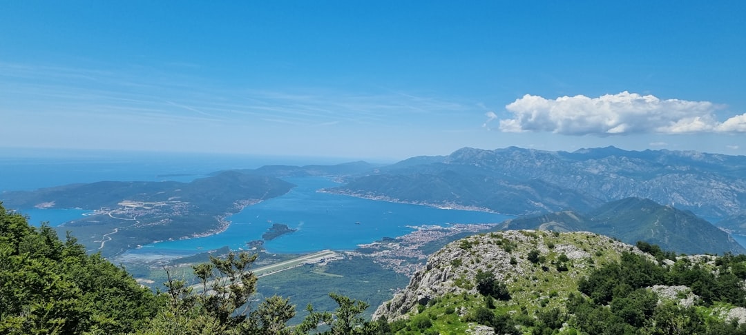
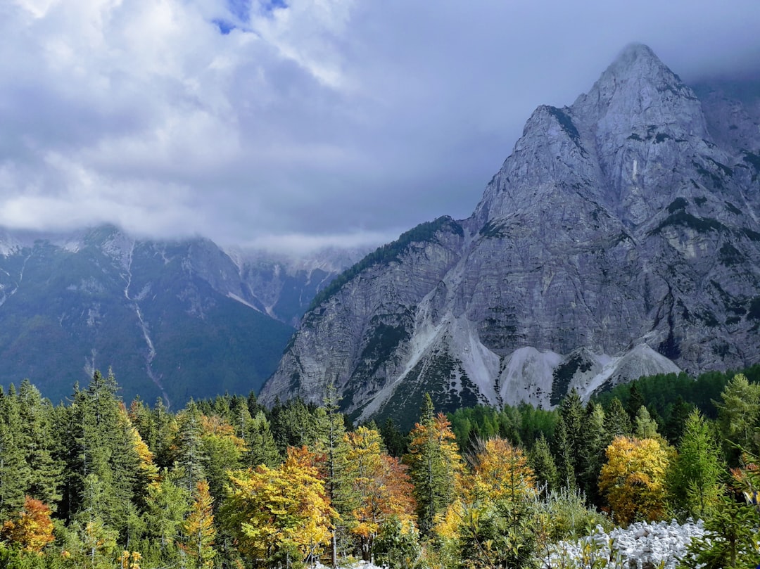
The southern end of the trail kicks off in Montenegro, specifically around the Boka Kotorska bay. The terrain here is dramatic, jagged, and unforgiving. You start near the sea but climb fast into the karst landscape that defines this region. The rocks are ancient, gray, and covered in patches of hardy scrub. The views are stark, offering a brutal beauty that feels almost alien. You are hiking through a landscape that has resisted human settlement for centuries, save for the occasional stone hut or abandoned shepherd's cabin.
One of the key landmarks in this section is Orjen mountain. It towers over the bay, and hiking its ridges exposes you to winds that can strip the heat right off your skin. The trail here is often a narrow ledge with a drop-off that makes you check your footing twice. There are no cafes here. You carry everything you need. The isolation is the point. When you finally descend back toward the towns of Perast or Kotor, the contrast between the wild mountains and the baroque coastal architecture is jarring in the best way possible.
As you move north, the trail enters Bosnia and Herzegovina. The landscape shifts slightly, becoming a bit more vegetated but still dominated by limestone. The Via Dinarica here passes through some of the most remote areas of the Balkans. You might see a village that hasn't seen a new building in fifty years. The silence is profound, broken only by the wind or the distant bleat of sheep. This section tests your endurance, as the elevation gains are steep and the water sources are sparse. You learn to love your water filter here.
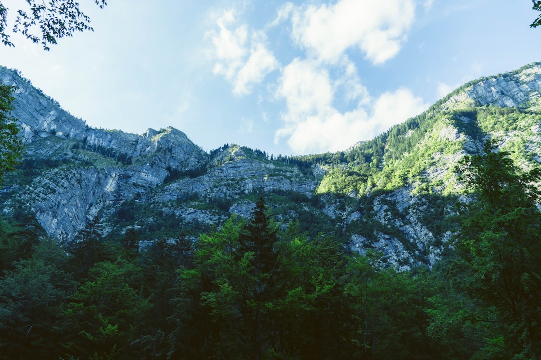
The Middle Stretch: Bosnia's Green Corridor
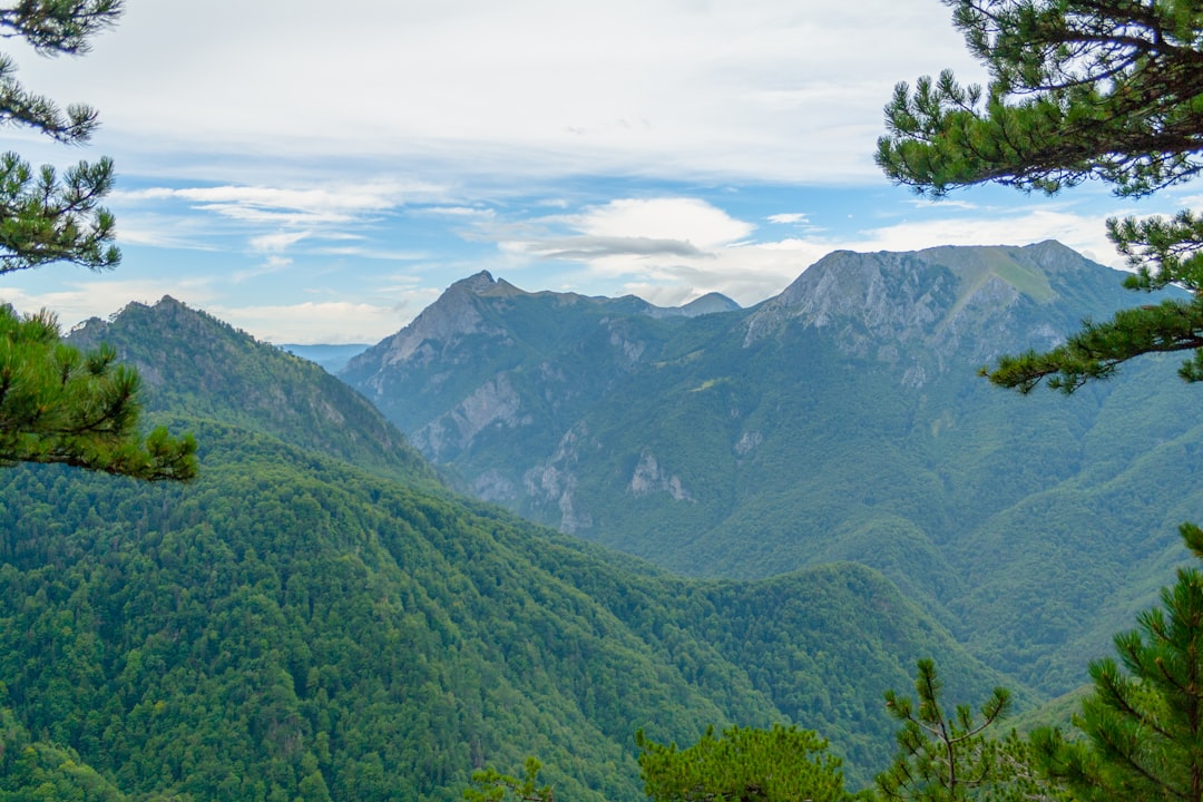
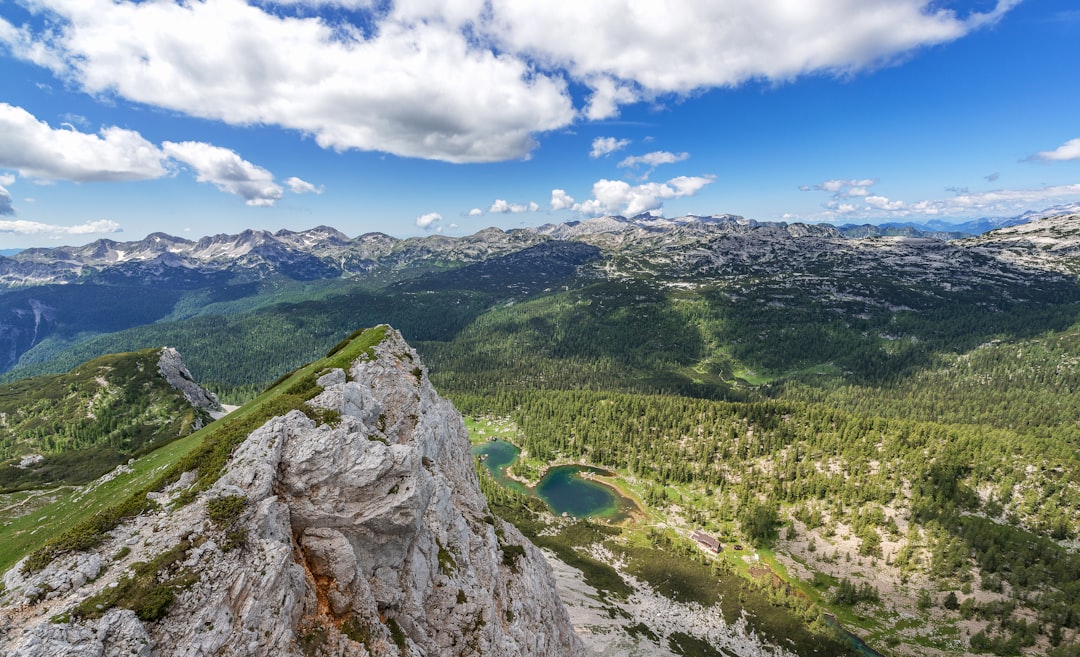
Entering Bosnia and Herzegovina properly, the trail winds through the Piva river canyon and into the highlands of Herzegovina. The Sutjeska National Park is a major stop here, offering a mix of forest and high peaks. The Maglić peak, the highest in Bosnia, is a significant challenge on the route. The trail here is well-marked but remote. You might go days without seeing a car. The hospitality in the small villages you do pass through is legendary; locals will often offer you coffee or food, a stark contrast to the isolation on the trail.
The Via Dinarica cuts through the heart of the Dinaric Alps, crossing borders that once meant war and now mean just a slight change in vegetation. In Bihać, you hit a more populated area, a chance to restock and soak up some local culture before heading back into the wild. The trail here feels less like a hike and more like an expedition. The terrain is rugged, with rocky descents and steep ascents that will burn your quads. But the reward is a sense of adventure that is rare in modern Europe.
The Northern Ascent: Croatia's Karst to Slovenia's Green
As the trail moves into Croatia, you enter the Lika region. This is one of the most sparsely populated areas in the country, a vast plateau of beech forests and karst fields. The Plitvice Lakes are nearby, but the Via Dinarica takes a more rugged path through the Velebit mountain range. Velebit is a wild place, with deep gorges and high peaks. The trail here is technical, requiring good boots and a head for heights. The views from the top of Velebit are expansive, looking out over the Adriatic to the south and the Pannonian plains to the north.
Crossing into Slovenia, the landscape changes dramatically. The stark karst gives way to lush green meadows and dense forests. Triglav National Park is the final major destination for many hikers on the Via Dinarica. Triglav, the highest peak in Slovenia, is a symbol of Slovenian identity, and reaching it feels like a pilgrimage. The trail here is well-maintained, with mountain huts available for shelter. The Julian Alps offer a different kind of beauty, softer and greener than the Balkan south, but no less impressive. The air is crisp, and the views of the Soča river valley are stunning.
On the Ground: Logistics and Reality
Walking the entire Via Dinarica is a massive undertaking. It takes months, not weeks. Most hikers tackle sections, spending a few weeks in one country before moving on. The trail is marked with the distinctive blue and white Via Dinarica signs, but navigation can still be tricky in poor weather or in remote areas. GPS is essential. Water is a constant concern in the southern sections, so carrying capacity is key. In the north, water is more abundant, but rain is frequent, so waterproof gear is non-negotiable.
Accommodation varies wildly. In Montenegro and Bosnia, you might camp wild or stay in basic guesthouses. In Croatia and Slovenia, there are more mountain huts and hostels. Budget for 15-30 EUR per night for basic accommodation or camping fees. Food can be cheap if you cook your own meals, but eating out in tourist areas can quickly add up. A meal in a mountain hut might cost 10-15 EUR. You need to plan your resupply points carefully, as some sections are remote.
Getting There & What to Expect
The trail starts in Montenegro near Kotor. You can fly into Tivat Airport or Podgorica Airport and take a bus to Kotor. The journey from Podgorica takes about two hours and costs around 5-7 EUR. From Kotor, you can start hiking immediately. The trail ends in Slovenia near Triglav. You can fly into Ljubljana and take a bus or train to Kranjska Gora, the gateway to Triglav National Park. The journey from Ljubljana takes about an hour and costs around 5-10 EUR.
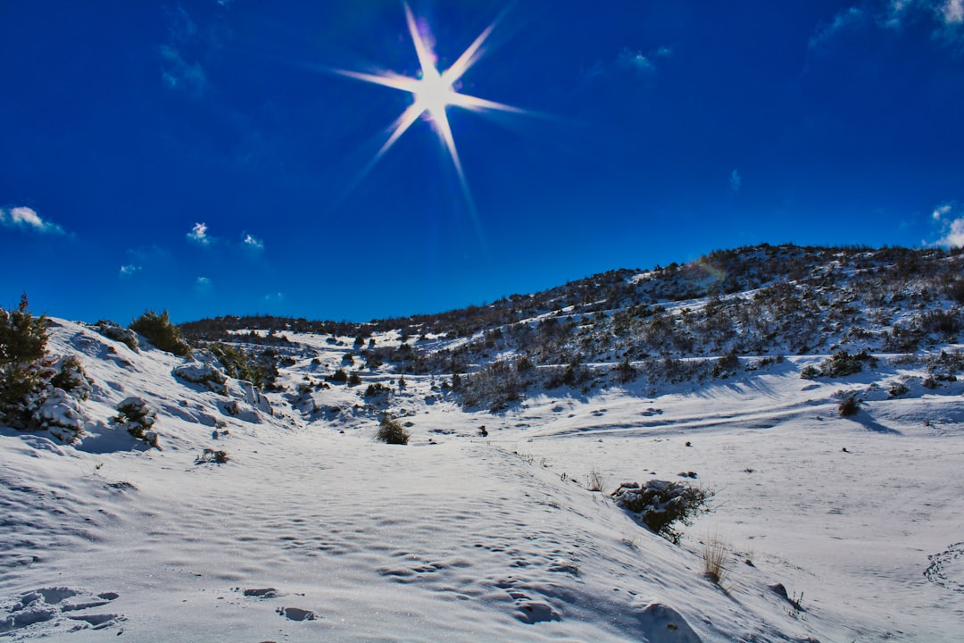
The best time to hike is from late spring to early autumn. Summer can be hot in the south and crowded in the north. Spring and autumn offer cooler temperatures and fewer crowds, but rain is more likely. Winter is not recommended for most sections due to snow and ice. You need to be prepared for all weather conditions, even in summer. Temperatures can drop significantly at night, especially in the mountains. Carry a warm sleeping bag and a four-season tent if you plan to camp.
Search accommodation in Kotor on Booking.com →
The Final Mile: Why It Matters
I stood on the summit of Triglav, looking back at the trail that had taken me months to walk. The view was spectacular, but it was the journey that mattered. The Via Dinarica isn't just a trail; it's a story. It's a story of resilience, of nature reclaiming land, and of people finding connection in the wild. It's not easy. It's not comfortable. But it's real. And in a world that is increasingly digital and disconnected, that reality is a rare and precious thing. If you have the time, the fitness, and the desire to see the Balkans as they truly are, this is the trail for you. Just pack extra socks, and maybe a few extra cans of beans.
Comments