


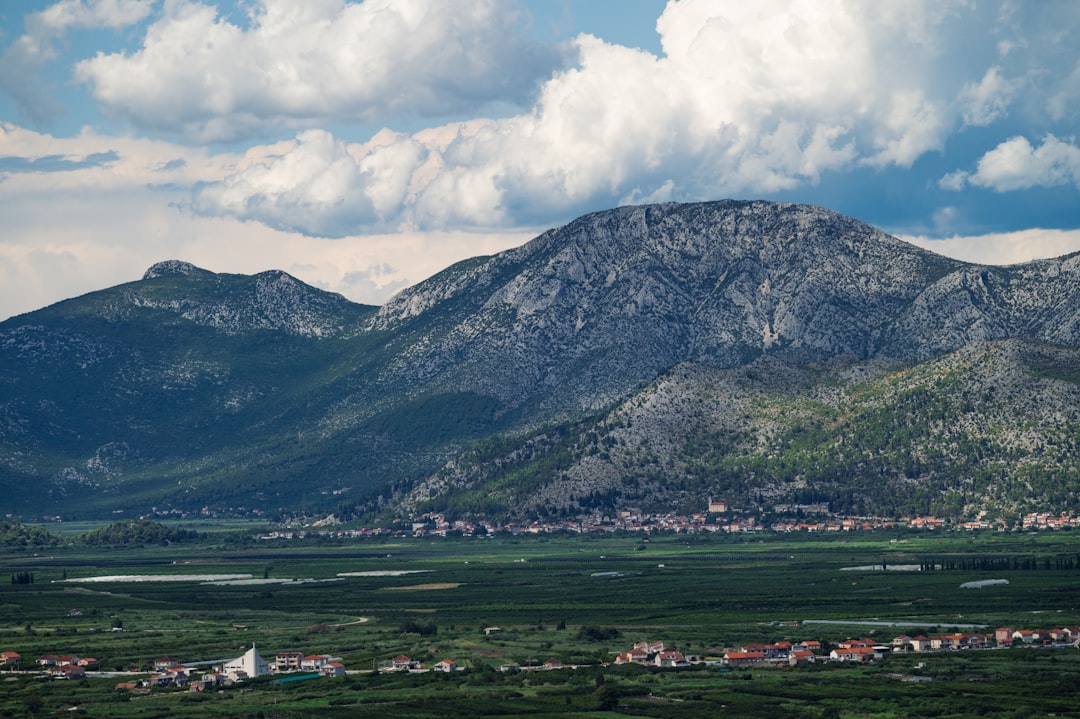
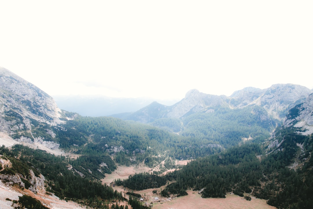
The wind on the Velebit doesn't just blow; it hunts. I stood on a ridge near Veliki Krš, my coffee cup rattling in my hand like a drum in a storm, watching a hawk circle a thermal that smelled of pine resin and ancient limestone. There are no crowds here. No selfie sticks. Just the brutal, beautiful geometry of the Dinaric Alps tearing into the Adriatic sky. I had come to hike the Velebit Trail, a rugged spine of rock and forest that connects the northern and southern parts of this massive mountain range, and I quickly learned that this isn't a walk in the park. It's a negotiation with gravity, weather, and your own ego.
Most travelers fly past Zagreb to the coast, missing the mountainous heart of Croatia entirely. But the Via Dinarica, the long-distance path that stitches through the Balkans, finds its most dramatic chapter here. The Velebit section is raw, often shrouded in fog, and fiercely independent. It's for hikers who don't mind a little mud, a lot of steepness, and the occasional encounter with a local shepherd who looks at your Gore-Tex with amused skepticism.
The Backbone of the Balkans
The Velebit mountain range is the geological anchor of Croatia. Stretching over 140 kilometers along the Adriatic coast, it divides the country's continental interior from the sea, creating a dramatic weather front that dumps rain on the slopes while the coast basks in sun. The Velebit Trail (Velebitska staza) is the modern manifestation of an ancient desire to cross this barrier. It's a challenging route that demands respect, cutting through dense forests, barren karst plateaus, and towering peaks that pierce the cloud layer.
Historically, this was a land of shepherds, smugglers, and outlaws. The rugged terrain made it a perfect hiding place for those evading authority, and today, the trail still feels like a secret. You pass through small villages where time seems to have slowed, and the local dialect is thick with archaic words. The trail isn't just a physical path; it's a cultural corridor that preserves a way of life that is rapidly disappearing elsewhere in Europe.

Routes & Trail Info
The full Velebit Trail is a beast, but most hikers tackle sections of it. The most popular segment runs from Lišane Ostrovičke in the north to Zrće on the island of Pag in the south, though many focus on the central and southern parts. Here are the key approaches:
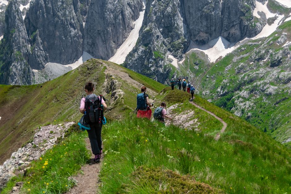
North Velebit Approach Starting from Lišane Ostrovičke, this route takes you into the North Velebit National Park, home to Vaganski Vrh, the highest peak in Croatia at 1,757 meters. The terrain here is steep and rocky, with significant elevation gain. Distance: ~15 km one-way to the summit area Elevation Gain: ~1,200 meters Duration: 6-8 hours Difficulty: Experienced. Requires good fitness and sure-footedness.
Central Velebit Traverse This section connects the interior villages with the coastal towns. It passes through dense beech forests and open pastures. The trail is well-marked but can be muddy. Distance: ~20 km per day typical Elevation Gain: ~800-1,000 meters daily Duration: 5-7 hours Difficulty: Intermediate. Suitable for fit hikers with experience.
South Velebit High Route The southern section is more exposed, with stunning views of the Adriatic and the islands of Pag and Rab. The trail climbs to Veliki Kuk (1,630 meters), offering panoramic vistas. Distance: ~12 km one-way to Veliki Kuk Elevation Gain: ~900 meters Duration: 5-6 hours Difficulty: Intermediate to Experienced. Exposure and weather can make it tricky.
On the Ground: Survival and Style
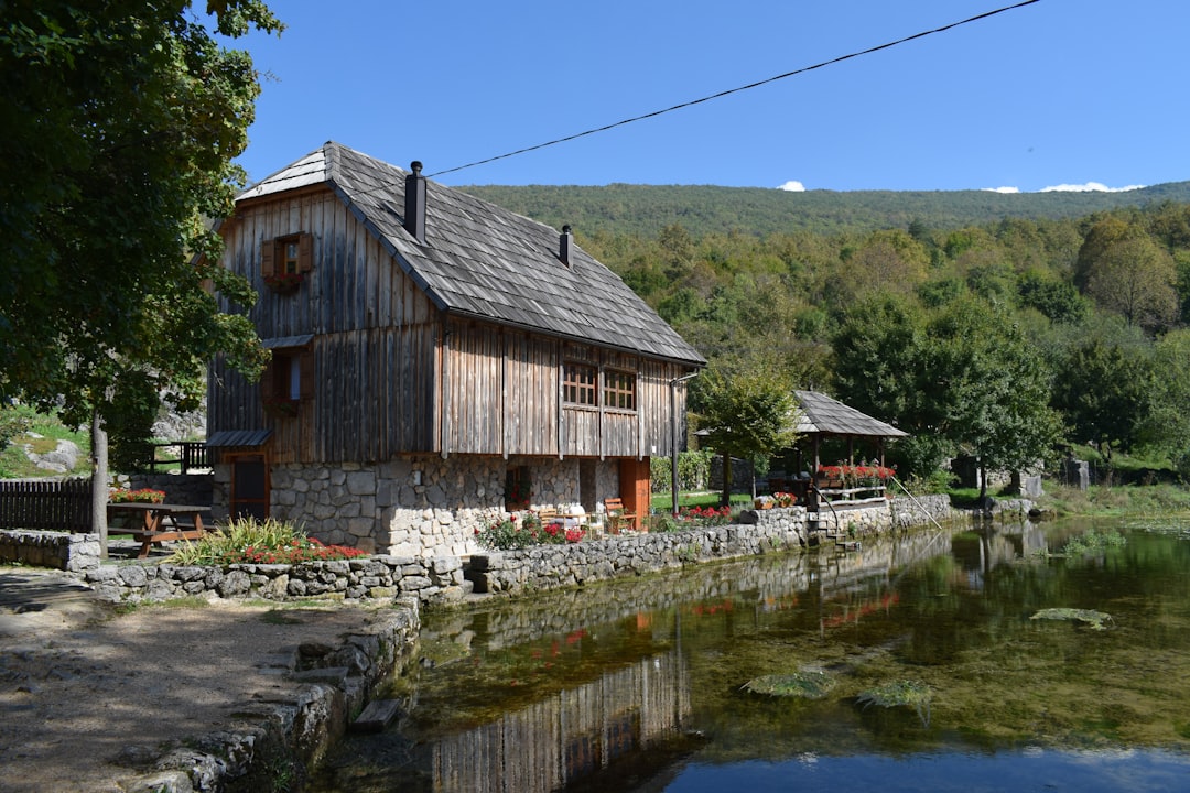
Accommodation on the trail is sparse but charming. You'll find planinarske kuće (mountain huts) and family-run seoske kuće (farmhouses) in villages like Brod Moravice and Lukovo Selo. These aren't luxury hotels; they're clean, simple places with hearty food and local wine. Expect to pay 20-40 EUR for a bed in a dorm or shared room, and 10-15 EUR for a meal that will likely include homemade cheese, cured ham, and polenta.
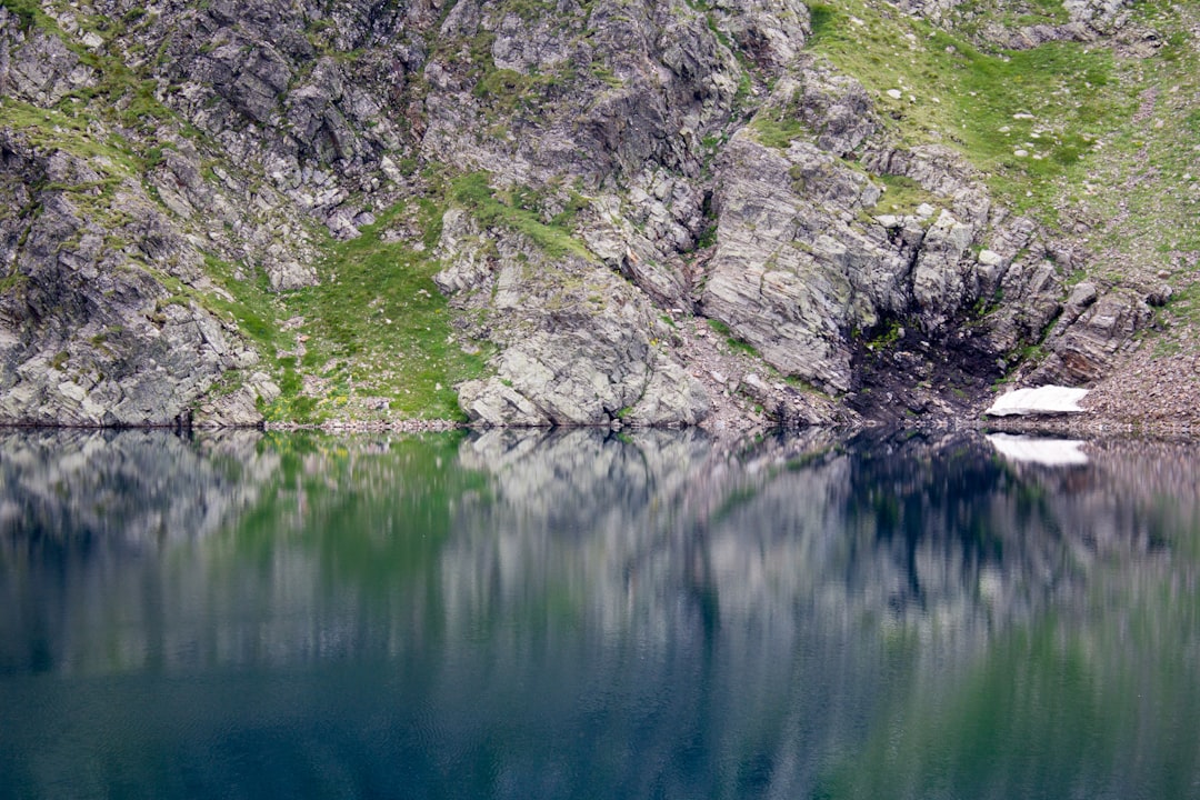
Water sources are generally available from streams and springs, but you must treat or filter them. The weather is the real wildcard. In the summer, it can be hot and dry, but afternoon thunderstorms are common. In spring and autumn, fog and rain can reduce visibility to near zero. Navigation skills are essential. GPS apps like Maps.me or Komoot are indispensable, as trail markers can be obscured by vegetation or weather.
Local transport is limited. Buses run from Rijeka to major towns like Krk and Pag, but you'll need to arrange taxi or shuttle services to reach trailheads. Renting a car is the most flexible option, allowing you to hike out and back from the same point or create a loop.
Getting There & What to Expect
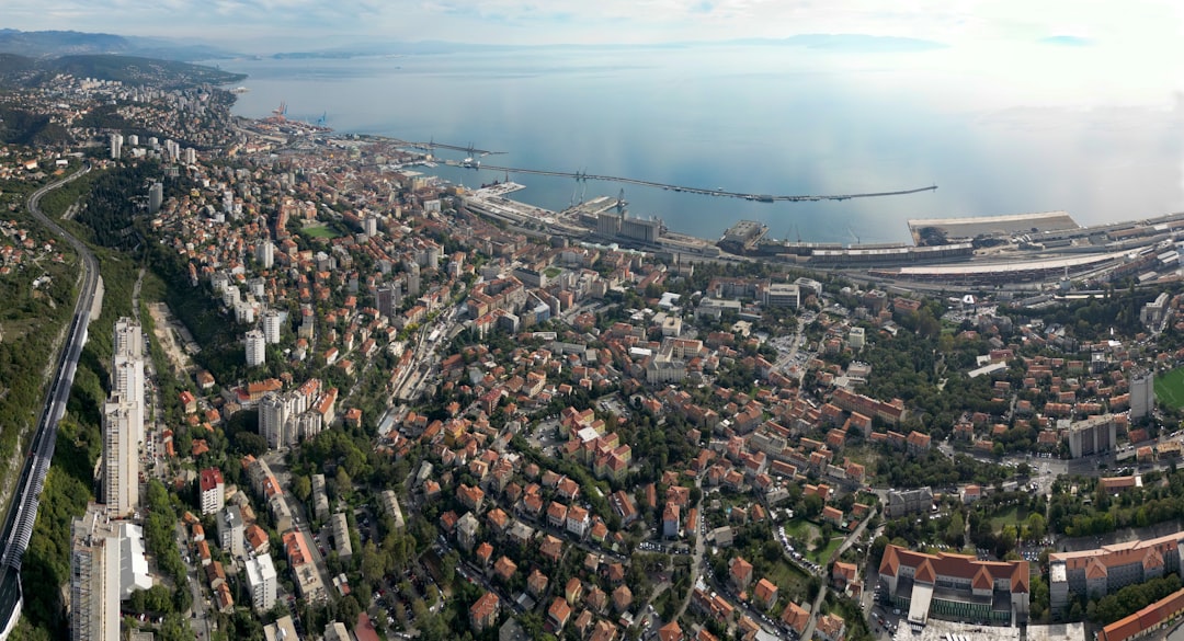
The nearest major hub is Rijeka, with its own airport and train connections from Zagreb. From Rijeka, it's about 1.5 to 2 hours to drive to the northern trailheads near Lišane Ostrovičke or Brod Moravice. For the southern section, Zadar is the gateway, with ferries to Pag and Rab.
Budget travelers can find hostels in Rijeka and Zadar for 20-30 EUR per night. Mid-range hotels in coastal towns range from 60-100 EUR. Food is affordable, with local markets offering fresh produce and dairy products. A typical hiker's breakfast of bread, cheese, and coffee costs 3-5 EUR.
The best months to hike are May to June and September to October, when the weather is mild and the crowds are thin. July and August can be hot and busy, especially on the southern trails.
Search accommodation in Rijeka on Booking.com →
Before you go, remember: this is the Velebit. It doesn't care about your schedule. It demands patience, respect, and a willingness to get lost. I ended my hike soaked to the bone, shivering on a ridge, but grinning like a fool. The wind was still howling, but I finally understood its language. It wasn't hunting me anymore. It was welcoming me home.
Comments