


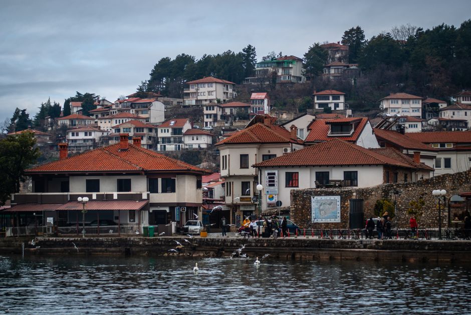
The gravel crunches under my boots with a sound like grinding teeth, a rhythmic percussion that has echoed here for two millennia. I am standing on a ridge overlooking Ohrid, the air thick with the scent of pine and the metallic tang of approaching rain. It's not just a hike; it's a temporal slip. One moment I'm checking my phone for a signal that doesn't exist, the next I'm staring at a strip of cobblestones so worn they look like river stones, laid down by men who spoke Latin, not Macedonian. The locals call this the Via Egnatia, but walking it, you forget the grand imperial titles. You just feel the weight of the stone, the stubbornness of the route, and the eerie silence of a road that connected empires but now only connects a few stubborn walkers to the ghosts of the past. I slipped on a loose slab near the old fortifications, scraping my knee, a small, sharp reminder that history is not just read; it is walked, stumbled upon, and occasionally hurts.
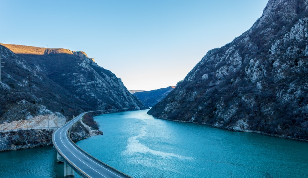
This is not a paved tourist trail with helpful signage and gift shops at the summit. This is the raw, unvarnished backbone of the Balkans. The Roman road network here was the internet of the ancient world, a digital fiber-optic cable made of granite and sweat, stretching from the Adriatic coast to Constantinople. In North Macedonia, the route curves around the northern shore of Lake Ohrid, one of the oldest and deepest lakes in Europe. To trace it is to trace the spine of the region's history, a jagged line that dictates where cities grew, where battles were fought, and where the sun sets over a landscape that has seen legions, nomads, and now, a few bewildered travelers trying to find the path in the overgrown brush.
The Imperial Artery
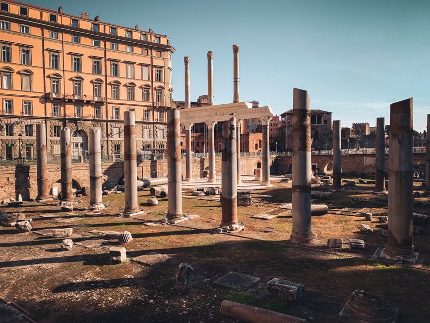
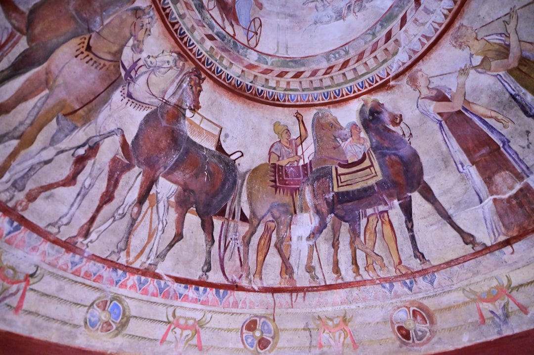
The Via Egnatia was commissioned by Gnaeus Egnatius, a Roman consul, around 146 BC. It wasn't just a road; it was a statement of power, a concrete assertion that Rome owned the Balkans. The route connected Apollonia and Dyrrachium on the Adriatic Sea to Byzantium (later Constantinople) on the Bosphorus. For centuries, it was the primary land link between Rome and the East, carrying soldiers, merchants, senators, and eventually, the plague. In Ohrid, the road didn't just pass through; it integrated with the settlement, turning the lakeside town into a crucial node in the imperial network. The Romans valued efficiency and durability, and the sections remaining near Ohrid are testaments to that engineering prowess, built to last millennia rather than mere decades.
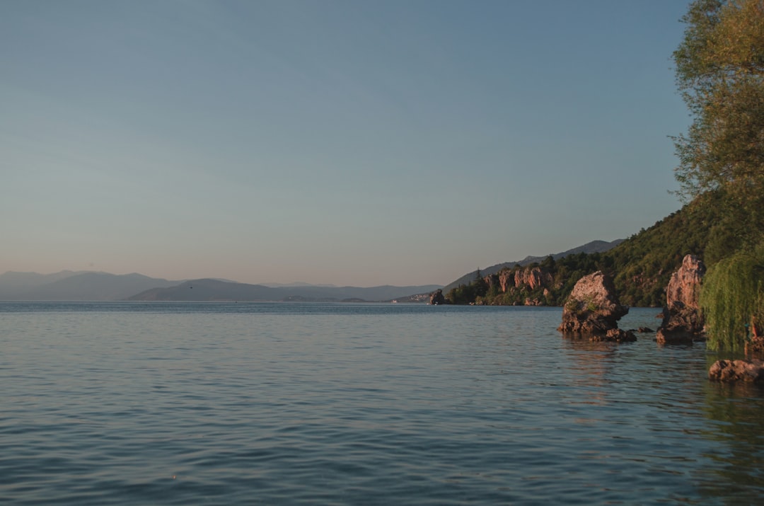
What makes the Ohrid section unique is its interaction with the terrain. The road hugs the northern shore of Lake Ohrid, a UNESCO World Heritage site, winding through valleys and across ridges that offer panoramic views of the water. It's a route that balances strategic necessity with geographical reality. The Romans had to contend with the rugged Dinaric Alps and the shifting tectonic plates of the region, yet they managed to create a path that was remarkably straight and direct. Walking it today, you can see how the road dictated the layout of the old town, with many of the medieval and Ottoman structures built directly on top of or adjacent to the ancient Roman foundations. It's a palimpsest of history, where each layer is written over the last, but the underlying text remains visible if you know where to look.
The preservation of these sections is uneven. Some parts are clearly defined, with large cobblestones still in place, while others are mere suggestions, faint depressions in the landscape or lines of stones that have been repurposed for walls and foundations. This fragmentation adds to the mystery, forcing walkers to become detectives, piecing together the route from fragments of stone and local lore. It's not a passive experience; it requires engagement, observation, and a willingness to get lost in the details. The road is not a straight line here; it is a conversation between the Romans and the land, a dialogue that continues to this day.
Walking the Stones
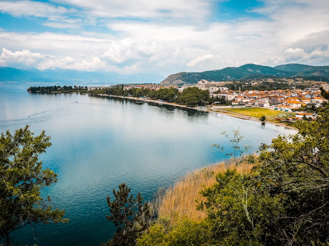
The best place to start tracing the road is from the Old Bazaar in Ohrid, a labyrinth of narrow streets and Ottoman-era houses that feels worlds away from the Roman imperial highway. From here, you can head towards the Samuil's Fortress, where the road once climbed up to the citadel. The ascent is steep, but the stones are still visible, worn smooth by centuries of feet. From the fortress, you can see the entire northern shore of Lake Ohrid, a vast expanse of blue that seems to stretch to the horizon. It's a view that would have been familiar to Roman soldiers marching east, a constant reminder of the natural beauty that surrounded their brutal march.
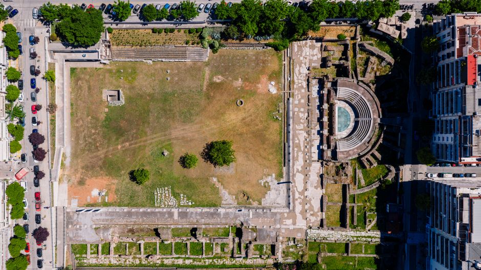
Further east, near the village of Stobi, the road becomes more defined. Stobi was one of the most important Roman cities in the region, and its ruins are a treasure trove of imperial history. The road here is wider, with large cobblestones that speak to the city's importance. Walking from Stobi towards Ohrid, you can see how the road connected the two settlements, a vital link in the imperial network. The landscape here is more open, with fields and vineyards stretching out on either side of the road. It's a peaceful walk, but one that is steeped in history, every stone a reminder of the empire that once ruled these lands.
The final section of the walk, from Stobi back to Ohrid, is perhaps the most rewarding. The road winds through olive groves and pine forests, the air filled with the scent of wild herbs. As you approach Ohrid, the lake comes back into view, a shimmering blue in the distance. It's a fitting end to the walk, a return to the city that has been the heart of this region for millennia. The road may have changed, but the lake remains, a constant presence in a landscape that has seen empires rise and fall. It's a reminder that while the stones may crumble, the land endures.
Routes & Trail Info
For those looking to walk the Roman road around Ohrid, there are two main routes to consider. The first is the Ohrid Old Town to Samuil's Fortress route, a short but steep walk that takes about 30-45 minutes. This route is suitable for most fitness levels, but the stones can be slippery, so sturdy footwear is essential. The second route is the Stobi to Ohrid walk, a longer hike that covers about 10-12 kilometers one way. This route is more challenging, with some steep sections and uneven terrain, but it offers a more comprehensive view of the Roman road and its surroundings. It takes about 3-4 hours to complete, depending on your pace and how many stops you make to explore the ruins.
Route 1: Ohrid Old Town to Samuil's Fortress Distance: 1.5 km (one-way) Elevation gain: 150 m Estimated duration: 30-45 minutes Difficulty: Intermediate (due to steepness and uneven stones) Starting point: Old Bazaar, Ohrid Ending point: Samuil's Fortress, Ohrid
Route 2: Stobi to Ohrid Distance: 12 km (one-way) Elevation gain: 300 m Estimated duration: 3-4 hours Difficulty: Intermediate to Advanced (due to length and terrain) Starting point: Stobi archaeological site Ending point: Old Bazaar, Ohrid Note: This route passes through rural areas and vineyards, so bring water and snacks. There are no facilities along the way.
Getting There & What to Expect
Ohrid is well-connected by air and road. The nearest airport is Ohrid St. Paul the Apostle Airport, which has seasonal flights from various European cities. Alternatively, you can fly into Skopje, the capital of North Macedonia, and take a bus or taxi to Ohrid, which takes about 3 hours. From Ohrid, the Stobi archaeological site is about 20 kilometers away, reachable by taxi or local bus. Taxis cost around 15-20 EUR one way, while buses are cheaper but less frequent.
Accommodation in Ohrid ranges from budget hostels to luxury hotels. A night in a hostel costs around 15-25 EUR, while a mid-range hotel costs 40-70 EUR. For dining, you can expect to pay 5-10 EUR for a meal at a local restaurant, with street food and snacks available for 2-5 EUR. The best time to visit is during the spring (April-May) or autumn (September-October), when the weather is mild and the crowds are smaller. Summer can be hot and crowded, while winter is cold and some trails may be closed.
What to expect is a mix of history, nature, and physical challenge. The road is not for the faint of heart; it requires good fitness and sturdy footwear. The terrain is uneven, and the stones can be slippery, especially after rain. However, the views are spectacular, and the sense of history is palpable. You will feel like you are walking in the footsteps of emperors and soldiers, a unique and unforgettable experience. Bring water, snacks, and a map, and be prepared to get lost in the beauty and mystery of the Roman road.
Search accommodation in Ohrid on Booking.com →
The Ghosts in the Gravel
As the sun dips below the hills, casting long shadows over the cobblestones, I sit on a Roman slab, my legs aching, my mind reeling. The silence here is profound, broken only by the distant call of a bird and the rustle of wind in the pines. I am alone, yet surrounded by the echoes of millions who have walked this path before me. The road is a ghost, a phantom limb of the empire, but it is a ghost that still haunts the landscape, shaping it, defining it, reminding us of the fragility of human endeavor. I touch the stone, cold and hard, and for a moment, I feel the pulse of the past, a faint but undeniable beat that says: we were here, we walked here, and we left this mark. It is a humble mark, but it is ours. And in that humility, there is a strange kind of immortality.
I stand up, brush the dust from my knees, and look back at the road. It stretches out before me, a ribbon of stone leading into the twilight. I don't know where it goes now, or where it will lead tomorrow. But I know that it has led here, to this moment, to this place, to this feeling of connection with something larger than myself. And that is enough. The road is not just a path; it is a promise, a promise that we are part of a larger story, a story that began long before us and will continue long after. And as I turn to walk back to Ohrid, I carry that promise with me, a small stone in my pocket, a reminder of the ghosts in the gravel, and the enduring power of the road.

Comments